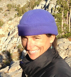
Thirty miles from the nearest trailhead, in the remote and trail-less Ionian Basin, the Enchanted Gorge had captured my imagination on the map over a decade ago because of those rock formations, Scylla and Charybdis, guarding the entrance. The Gorge slices through a metamorphic massif called The Black Divide at the center of the California Sierra Nevada.
I found an approach and very general description of the trip online. Bill Finch had done it solo, too. That online account and a map were the sum total of my research for my solo descent of the Enchanted Gorge. Perhaps I could have prepared more. Perched on a thin ledge over the Gorge's swollen creek, wondering if there was a better way down the damn thing, I did hate myself for not reading every friggin' thing ever written about hiking the Enchanted Gorge.
Bill had taken five days. I gave myself a week.
My confidence in my ability to keep up with the Bill Finch itinerary got its first major blow right away. I left the trailhead at Courtwright Reservoir at 10a and followed a beautiful trail 14 miles through lodgepole pine forest and up to meadows in the Red Mountain basin. Bill continued up and over Hell For Sure Pass his first day and camped on a bench on the other side. But I staggered into camp at Diasappointment Lake at 5:30p, one and a half miles shy of Bill’s effort, exhausted and unable to go a step further. I dropped my pack and it fell with a forty pound thud.
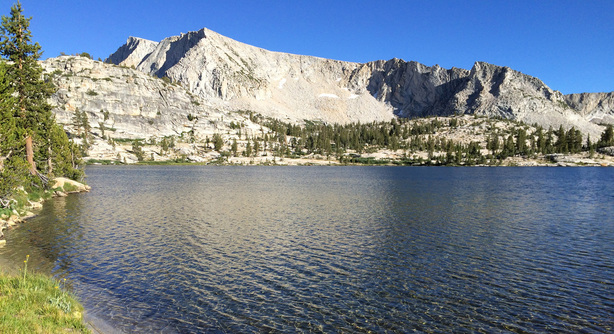
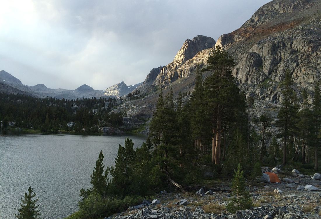
Disappointment Lake, however, was far from a disappointment. Whereas I had passed boisterous crowds of people at the lower Fleming Lake, I had this tranquil lake all to myself. Gorgeous.
Preconceived notions and reality took separate paths after this. I had to throw Bill’s itinerary out the window. Like Bill, I planned on a second breakfast at Martha Lake, or maybe elevenses. I should have looked at the map more carefully.
I left the granite of Red Mountain Basin behind me. Beyond the pass I entered the darker world of metamorphic rock along the Black Divide. I saw long views down the San Joaquin River to distant peaks. Across from me, waterfalls cascaded down barren, dark, and impossibly steep canyon walls. Upstream views were blocked, so I just trusted the trail, which eventually took me the direction I wanted to go, upriver. I dropped off the pass and onto a long bench with lodgepole and flowers. I finally reached the banks of the San Joaquin in a beautiful lupine meadow. As I hiked up towards Martha Lake, I gradually left the trees behind. I passed three hikers who, like most I met on the trail yesterday, had never heard of the Enchanted Gorge. One horse packer yesterday had known of it. He whistled and said he hoped I’d given myself a couple weeks to do it. These three coming from Martha Lake were the last people I’d talk to for five days. Eight miles from Disappointment Lake, at 1p, I finally arrived at Martha Lake.
Martha Lake, at 11,000 feet, is the windswept headwaters of the San Joaquin River, surrounded on three sides by talus and rock massifs – the LeConte Divide, Mt. Reinstein, Mt. Goddard. Not a tree in sight.
The head of the Enchanted Gorge is beyond Martha Lake, in the Ionian Basin. I had envisioned the Ionian Basin as a hospitable landscape of granite-lined lakes, meadows and wildflowers, rising gently from Martha Lake. I mean, wasn’t Ithaca, in the Ionian Sea, the sought-after and welcome homeland of Odysseus? To my dismay, my compass pointed me up a steep slope of sharp talus at the end of the lake, through black, chiseled rocks, to an even steeper scree exit chute that rose to the skyline. Disbelieving, I confirmed with my GPS.
Ah. Well, there you have it.

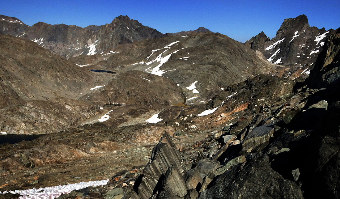
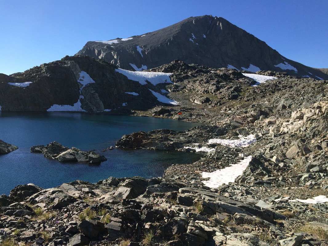
Finally topping the last few feet of the highest talus ridge, I expected to find the Ionian Basin spread out before me. Instead, I was above another lake, nestled in the dark rock, surrounded by snow and rock. Goddard owned the northern horizon, a black hulk from here. The southern end of the lake, bordered by foreboding cliffs, dropped over an edge and out of sight. My heart fluttered as I glimpsed the sun-soaked distance, the horizon was a stark contrast to where I was. It was light and granitic compared to the dark and sharp metavolcanic rock around me, sunlit compared to the shadowed, snow-covered talus. But here I was, at 12,240 feet, utterly hollow and alone.
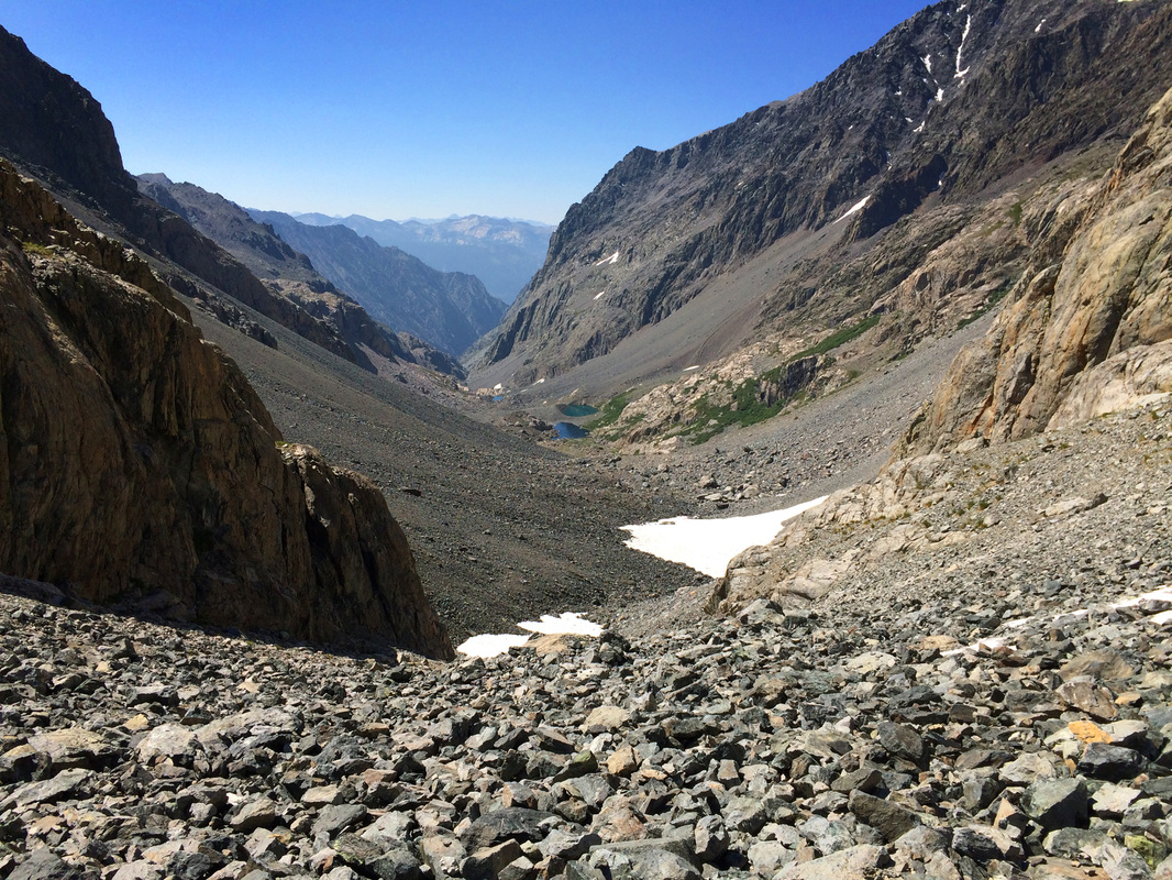
I was dismayed and tired and at high elevation where my courage is weakest. I felt like fleeing. But I decided to put off any decisions until morning. I set up camp in the one flat spot among the talus at the north end of the lake. A small ramp led up to the long-awaited view of the Ionian Basin to the east. Expecting the usual uplifting of my heart that distant views and landscape perspectives give me, instead my heart sank. The basin below me was dark -- reds, browns and black -- punctuated with snowfields, covered in talus, hardly a wisp of vegetation in sight. It was Mordor. I saw square-topped Scylla on the rightmost horizon and what might be the top of the Enchanted Gorge, high and steep and forbidding. My courage pooled down around my ankles.
As I tossed in my sleeping bag that night, snatches of conversations over the past six months came back to me.
“Solo in such a remote part of the Sierra? Isn’t that dangerous?”
“I need to tell you about a very experienced hiker who fell through a snow bridge above a roaring river and wasn’t found for five years…”
“Aren’t you nervous about hiking alone?”
(For the record, my gurlfriend climbing buddies and my husband never voiced anything but enthusiastic support).
Images of the ominous notch I’d seen from a distance came back and haunted my dreams.
When the sun rose the next morning, I was rested, my courage had adjusted to the altitude, and I had the map in my hands. The burning question, the one that really perplexed me, “What would I do with myself if I didn’t do Enchanted Gorge?” I was an explorer, not one to camp at a lake for days. I had to move. I decided, finally, to hike to the mouth of the Gorge and see what it looked like.
So I crossed the Ionian basin, past beautiful unnamed lakes, past the upside-down reflection of the massive Goddard, across an isthmus that drained an entire lake, but that I could jump across and past what – at the distance of my campsite – I thought had been the ominous, narrow mouth of the gorge. Not. Although next to Scylla, at 12,320’, it was much too high. I glissaded down 1,000 feet of perfect corn snow, with a wild smile on my face and whoops of joy.
I was finally able to see the mouth of the Enchanted Gorge. It was a wide and inviting opening in the mountains, a portal through which the sun virtually beamed, through which I could see distant mountains and valley-bottom lakes. I stood transfixed. In awe. Yes, enchanted.
The top third of the Enchanted Gorge is wide and open to the sky. Although I was talus hopping, I found grass and flowers among the rocks in reds, yellows and pinks. Lower lakes drew me onward. Their shores were gentle, their water cool and refreshing. It was hot. I stopped and drank and ate and reveled in the Gorge. I was below 10,000’, and the thick air was making me giddy.
Below the lakes the Gorge narrowed. A waterfall cascaded down the eastern canyon wall, turned and became the wild river at the bottom of the Gorge. Between cliffs on one side, talus at the angle of repose (the angle just at the verge of sliding) on the other, and a deep, rushing river between them, options for hiking disappeared almost to the vanishing point.
I have one general rule for solo hiking. Whatever I do has to be reversible. It was about to be tested.
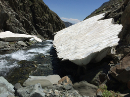
The canyon got steeper and narrower. At one point, I inched along a narrow ledge on a rock face above the churning river, testing every handhold and chanting “Keep it reversible, Jeanne”, convinced that I could retreat if needed. At another point, I stepped onto an impossibly steep talus slope where every footstep sent rocks sliding into the river. Momentum, here, was key. One of the more challenging places was where overhanging snow massifs blocked progress on either side. The only way to continue was to chimney up behind the snow formation, between the snow and the steep talus, pull myself over the lip onto the surface of the snow, and kick steps down the steep side to keep from sliding into the river.
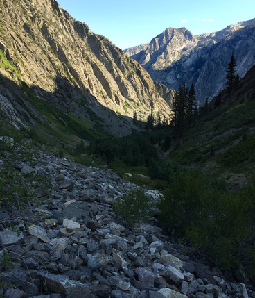
That was the narrowest part of the Gorge. Lower, the Gorge widened and cottonwood trees came into view, green leafy stands with their feet in the water. After so much rock and talus, it was an unbelievable relief to see deciduous trees. But that relief gave way to frustration at trying to move through the tangle of vegetation that crowded for space along the sides of the river. It was so thick and tall, it was impossible to bash through, and the river was too deep to walk in. Again, I was forced to hike the steep talus slopes, with intermittent manzanita and whitethorn copses to thrash through. The promised nettles appeared, and like Bill Finch my hands were soon on fire with stings. Putting them in the water only amplified the stinging.
Below me, I could see the Gorge widen further and turn westward, signaling its end and the joining with Goddard Creek. Exhausted, I promised myself I’d stop when I descended to the red fir trees I could see below. It was 7p by the time I found a level area of a gravel bar at 7,500’
Goddard Creek promised, of course, to be the Enchanted Gorge in reverse. On the map, the bottom of the Creek looked vegetated, possibly dense and tangled, the middle section narrow and steep.
But Goddard Creek was everything Enchanted Gorge was not. It was shallow and wade-able. There was plenty of room on either side of the river to boulder-hop/hike. There were slabs of rock to sit on and rest my feet in the water. The day was hot and the water was cool, so I put on crocs and walked upstream, relaxed.
As I ascended, the sides of the river rose into cliffs, and soon I was walking upriver in the middle of a beautiful deep gorge cut through the center of the drainage by the very river I was walking. The creek cascaded into deep step-pools, the water was clear, everything sparkled. There was plenty of room for me to walk. I was singingly happy. What a difference from this time yesterday…
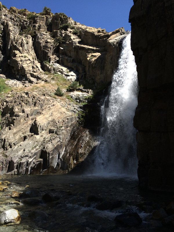
Then the gorge turned right and stopped. It ended in a grotto. A waterfall spewed from cliff walls forty feet above my head. It was beautiful. And it was impassable. I was at a dead end. Again, my extensive research had failed me.
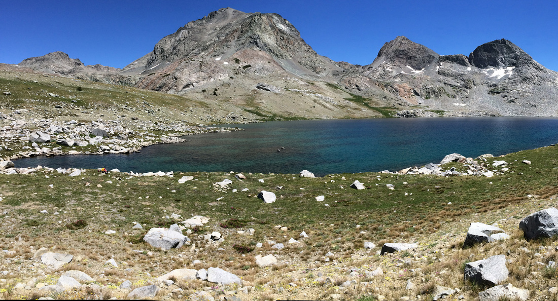
I finally got to the headwaters of Goddard Creek, possibly the most beautiful lake I have ever seen, at 9,797’. It has no name, but is surrounded by mountains, granite to the west, metavolcanics to the east. It lay on the very border between the two.
As I was pounding in the last tent stake, I heard the patter of raindrops on the fly. I threw everything inside the tent, including myself, just before the skies let loose. For the next hour I was treated to the staccato timpani of rain on my tent, and the crackling and booming of electricity above.
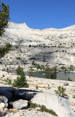 Finger Peak on the White Divide looks over the pass into Blackcap Basin
 I was almost relaxed in the morning. I had completed both the Enchanted Gorge descent and the Goddard Creek ascent, the major goals of my journey. But I still had a 11,555 foot pass to go over, and 11 miles to travel today. I dried out my tent, then finally packed up and started eastward, up into the Finger Peak Basin below the White Divide.
Granite, granite, granite!
Kiss, kiss, kiss!
I was I heaven, back in my element. Wide sheets of water flowed down over smooth, white rock. Lakes nestled in copses of large trees. Flowers were everywhere.
As I climbed higher, the view of the basin widened. The top of the White Divide was rimmed in cliff in all directions. I found Finger Peak, and thus Finger Col.
Just then, a cloud passed over the sun and I was reminded that dallying was not allowed today, that the same storm that chased me yesterday would certainly chase me today. And if the Gods had any sense of humor, all hell would break loose just as I was at the highest point, going over the pass.
I hoofed it upwards toward that distant pass as fast as my pack and my legs would carry me. The cliff at the top of the basin required some routefinding, blocks and ledges and careful movements across gaps, but finally I pulled myself over the top.
I was staring in the eyes of a tall, narrow, monolith, the Finger. And beyond it stretched Blackcap Basin, with Cathedral, Chapel and Midway Lakes. And along the distant horizon below me, the dim shapes of granite slabs and domes that lined the way to the trailhead. I smiled. Above me, the skies were still sunny.
But maybe the Gods were having a little fun at my expense. I suddenly saw that I was on a sheer cliff forty feet above the other side. Gulp. A little exploration, however, found an exposed traverse down to the gap between the basins and I was soon on the beaches of Cascade Lake with my feet in the water.
I was lucky to find the ledges that make the cliff below Chapel and Midway Lakes passable, just beyond Chapel Lake, then picked up the trail at Portal Lake.
The trail from Portal Lake was challenging to follow for the first mile or so, and I relied on my GPS, but after that it solidified and I was able to go into autopilot for the rest of the hike out to Big Maxson Meadow. The skies darkened behind me, above the White Divide, and filled with rumbling clouds. I could smell the distant rain. The Gods were either bidding me farewell or gnashing at my retreating heels.
I hiked out the remaining 12 miles to Courtwright Reservoir and the Maxson Trailhead. I happened to meet up with the horse-packer who had thought I’d need a couple of weeks to do the Enchanted Gorge. He was bringing out a string of horses.
“Well, if it isn’t the Enchanted Gorge Lady!” he greeted me, recognizing me.
I smiled. I was, and am, content to be called The Enchanted Gorge Lady.
